Posts

Showing posts from August, 2018

MERIT Drone Training in Sukhbaatar Aimag 2018

Image
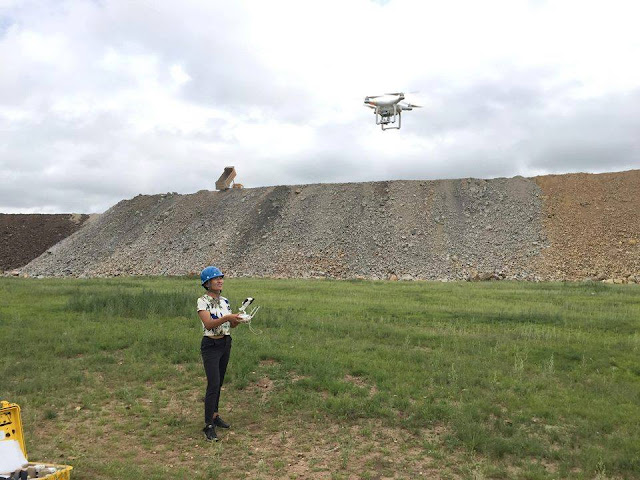
Introduction There are many YouTube videos that teach you how to fly drones, however they are generally focused on FPV (first person view) video or photo capture of nice panoramic views of local landscape. Our training is focused at teaching local government staff  on the use of drones for aerial mapping so that they can get updated maps that reflect current conditions. In addition they can use the drones for visual inspections of environmental and sensitive areas. Google satellite imagery has improved. You can get high resolution images of your community from it. Unfortunately these images could be old and do not reflect the latest land use. In the last five years technology has advanced to the point that some recreational drones can be used with high end mapping applications to create orthophoto maps. Coincidentally PC workstation hardware has also evolved to the extent that high end laptops can now be used to process the images from the drones. In addition expensive commerc

Georeference an unreferenced image with QGIS

Image
Introduction It is important to learn how to georeference an unregistered image such as an air photo or planimetric map so that you could use it with your GIS data. If you are using OpenDroneMap or Agisoft Photoscan to process the air photos from the drone you will get a georeferenced orthophoto as an output. This referenced or rectified image can be imported into QGIS and it will automatically be positioned in the coordinate reference system (CRS) that you used to process the photos. For example UTM Zone 49 for the Sukhbaatar aimag area. You should use a projected coordinate system for air photos instead of geographic coordinates. If you used Microsoft Image Composite Editor (ICE) to mosaic the photos, the exported image will not have a coordinate reference system attached to it. To use it with a GIS application you will need to georeference or register the map to a CRS. You can georeference your image with the Georeferencer GDAL plugin for QGIS. To georeference an image you w

Microsoft Image Composite Editor (ICE)

Image
The following tutorial covers the use of Microsoft Research's Image Composite Editor or ICE for drone mapping. Background Our initial goal was to use Open Drone Map (ODM) a FOSS4G application to create orthophotos from the autonomous drone images using DroneDeploy. At our training workshop we discovered that only three PC Workstations were able to install ODM. The remaining systems did not have enough computing capacity to process orthophotos. As a result an alternative was needed and we decided that MS ICE (free application) is a viable alternative for the majority there. Mongolian:  https://trainingquadcopters.blogspot.com/2018/07/opendronemap-with-docker-toolbox-for.html English:  https://trainingquadcopters.blogspot.com/2018/06/opendronemap-with-docker-toolbox-on.html Applications like ODM and Agisoft Photoscan automatically uses the EXIF coordinates in the drone photos to georeference the orthophoto map, ICE does not. ICE uses blending technology to stitch the phot

Sukhbaatar Naadam at Dariganga 2018

Image
Sukhbaatar Naadam 2018  Introduction Every five years Sukhbaatar aimag celebrates their Naadam at Dariganga. This year is the 105th year of that celebration. The Mongolian Naadam is a major traditional event that is celebrated annually every summer. The Naadam games include horse racing, archery and wrestling. My MERIT assignment coincided with the special Naadam celebration in Dariganga which is held later than the traditional period. Since it fitted my assignment schedule I was invited to participate. Getting There I flew from Ulaanbaatar to Choibalsan (Dornod aimag) where I met up with Selenge from the MERIT project office and we drove to Baruun_Urt, the aimag centre for Sukhbaatar, to store my gear and lunch then on to Dariganga sum, which is close to the Chinese border at the south end of the province. Link to:  Google Map of Altan Ovoo Once you leave the towns you travel on dirt roads which get pretty rough in places. The time it takes to drive from Choibalsa